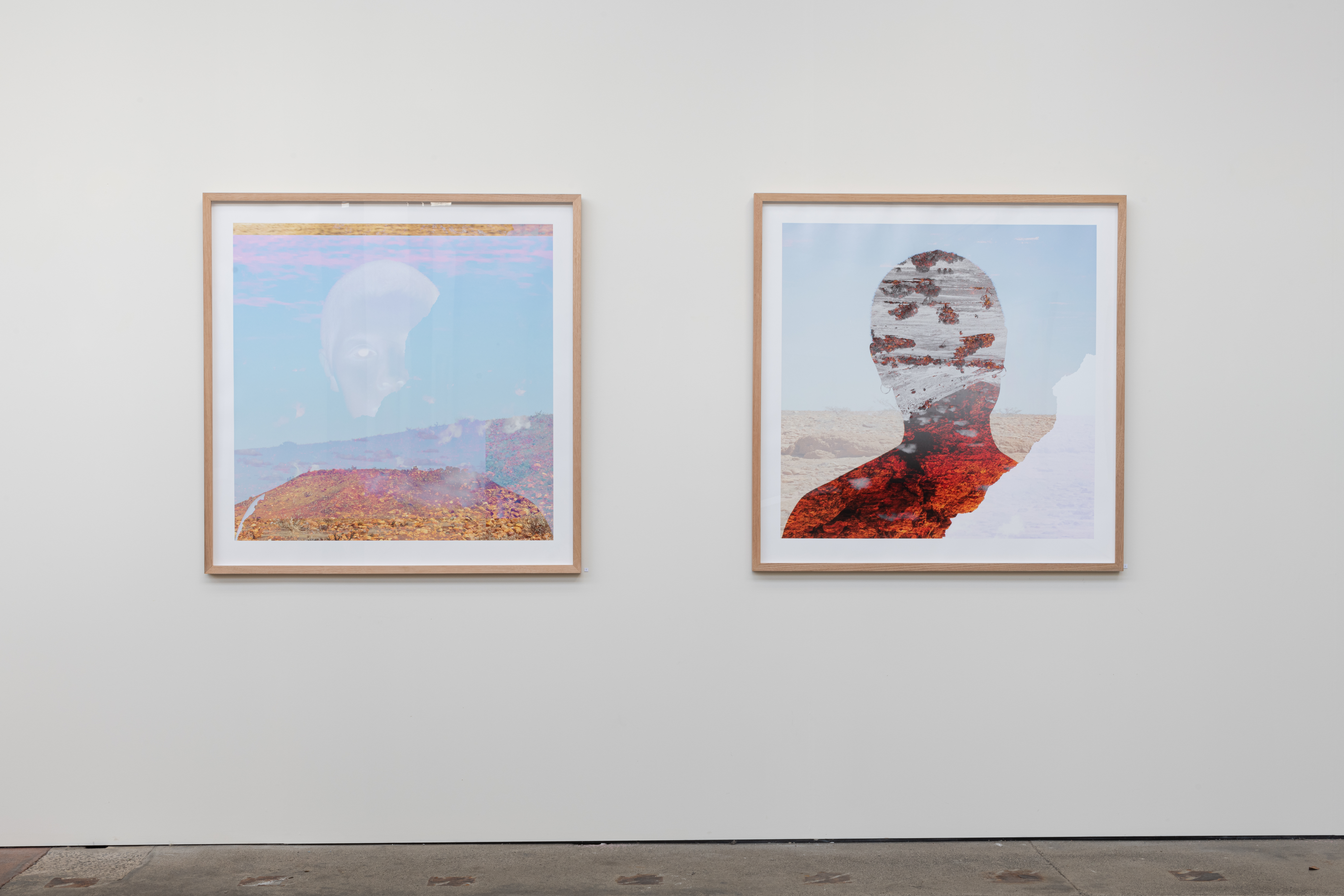
Australia has a complex history tainted with colonialism, the mass genocide of Aboriginal and Torres Strait Islander peoples and forced assimilation into the settler colony. The many products of colonialism are still prevalent and thriving today. Aboriginal and Torres Strait Islander people have inextricable connection to the land, to Country. For us, Country and self are intertwined and inseparable.
This series maps the intersections of place, identity, and family. It examines the encoded colonial biases present within different photographic technologies from an Indigenous perspective. The work critically analyses archive, representation, and questions the idea of photographs having their own agency.
(Dis)connected to Country aims to disrupt and subvert colonial approaches to image making and mapping systems, highlighting the omission of significant Indigenous Knowledges. This project is rooted in family history, story, and Country. It is dedicated to the sacrifices, strengths and resistance of my family.
For my matriarchs, forever and always.
These self-portraits have been created in response to the inaccurate and reductive representations of Aboriginal people created in archival colonial photographs.
It reflects on family documents and photographs held within state institutions, specifically images of family members in the Tindale Genealogical Collection. These photographs are a pursuit for control and agency over my own image and the camera itself.
As both photographed and photographer, I subvert the typical power dynamics present within archival images of family members. Such power dynamics renderd my family members as having no control over their image and what happend to the photographs after they were made.
Through the use of layering I have “submersed” myself back into Pitta Pitta Country, reflecting on the dislocation I have experienced as a result of the colonial project.
These images explore ways in which western visual systems of cartography have continued to omit Indigenous Knowledges of place, sustaining colonial narratives within Australia and the myth of ‘terra nullius’. Through practice-led research, these images aim to highlight the inherent biases in contemporary western digital mapping technologies, undermining the idea of western maps being ‘neutral’ tools. Such biases include resolution discrepancies between different places, and the subjectivity of maps in their creation. The work shows where these technologies dysfunction, degrade and break down within themselves.
These photographs are screenshots of Google Earth’s imaging of Pitta Pitta Country in transition between ‘Street View’ and ‘Satellite View’. The technology glitches and dysfunctions, representing a tear in the myth of ‘terra nullius.’
Imaging technologies incorporated in Google Earth have roots in the military industrial complex, surveillance technologies and continuing the colonial project.
The work ‘Waddi Tree’ is a photograph of a tree which was a meeting place for my people. It sits on top of its representation in Google Earth, reduced to a dark shadow of pixels.
According to Google Earth’s permission guidelines, I am infringing copyright and am not allowed to print, sell, or use this work for commercial or promotional purposes.
Google Earth continues to profit off images of stolen land.